Reading the Sky: Weather Planning Strategies That Keep Campers Safe

This guide covers practical weather-reading skills for campers who want to avoid getting caught in dangerous conditions. You'll learn which free forecasting tools experienced outdoorspeople trust, why regional weather patterns behave differently than your hometown forecast suggests, and how to build flexible trip plans that accommodate sudden changes. These aren't theoretical concepts—they're field-tested approaches from two decades of reading clouds, checking barometric pressure, and knowing when to pack up early.
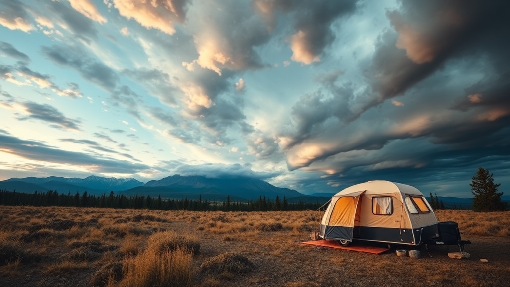
Why Does Weather Change So Quickly in Mountain and Desert Regions?
Most weather apps give you a single forecast for a zip code. That's fine for your backyard barbecue. It's nearly useless when you're camped at 8,000 feet in the Rockies or tucked into a canyon in the Mojave.
Elevation creates microclimates that defy broad regional forecasts. Temperature drops roughly 3.5°F for every 1,000 feet you climb—so a pleasant 75°F day at the trailhead can become a bone-chilling 40°F night at your campsite. I've watched afternoon thunderstorms materialize from clear blue skies in under 45 minutes in the Sierra Nevada, and I've seen fog roll off the Pacific so thick it turns a sunny coastal camp into a dripping, visibility-zero situation before dinner's ready.
Desert regions present their own surprises. The temperature swing between day and night can exceed 40 degrees. What feels like perfect sleeping weather at sunset—maybe 65°F with a light breeze—can drop below freezing by 3 AM. (Yes, even in Arizona. Yes, even in May.)
Valleys and ridges create wind tunnels that don't show up on standard forecasts. A "gentle breeze" prediction for the region might translate to sustained 25-knot winds howling through your campsite at 2 AM, shaking your tent like a washing machine with a brick inside. Understanding topography helps you predict these patterns.
What Are the Best Free Weather Resources for Backcountry Campers?
Experienced campers don't rely on the default weather app that came with their phone. We layer information from multiple sources—each reveals something the others miss.
The National Weather Service remains the gold standard for serious weather data. Their weather.gov site provides detailed zone forecasts, hazard warnings, and discussion pages where meteorologists explain their reasoning. The "Area Forecast Discussion" section is particularly valuable—it tells you how confident forecasters are about their predictions and what factors might change the outcome.
Mountain-Forecast.com specializes in elevation-specific predictions. Enter your campsite's approximate elevation and coordinates, and you'll get temperature, wind, and precipitation forecasts tailored to that exact spot—not the valley floor 2,000 feet below. This matters enormously when you're deciding whether to bring the four-season tent or the lightweight summer shelter.
Windy.com offers visual wind pattern mapping that helps you anticipate when conditions will shift. The interface shows you how weather systems move across regions over time—watching a low-pressure system approach your campsite three days out helps you plan accordingly.
Don't ignore the oldest weather tool: your eyes. Cloud formations tell stories. Cirrus clouds spreading across the sky often signal an approaching warm front 24-48 hours away. Cumulus towers building vertically by mid-morning suggest afternoon thunderstorms are likely. When you see mammatus clouds—those pouch-like formations hanging beneath anvil clouds—severe weather is either happening or imminent. Find shelter, not higher ground.
How Do You Build a Contingency Plan When Storms Threaten Your Trip?
Flexible planning separates campers who thrive from campers who bail. I never build a trip itinerary without identifying at least two alternative plans—what I call "Plan B" and "Plan C" campsites—before I leave home.
Plan B means a lower-elevation alternative to your primary destination. If you're aiming for a ridge-top camp at 9,000 feet and the forecast shows 50 mph winds with snow, you need a valley option at 6,000 feet that offers protection. Plan C means a completely different region—maybe the desert side of the mountains instead of the alpine zone, or a developed campground with facilities if dispersed camping becomes untenable.
Research your exit routes before you need them. Which roads remain passable in heavy rain? (Dirt roads in desert regions can turn to impassable grease after just half an hour of precipitation.) Where's the nearest reliable cell service if you need updated forecasts? Mark these on your map—not just mentally, but with actual waypoints.
Build weather buffers into your schedule. Arriving at camp with four hours of daylight remaining gives you options. Arriving at sunset forces you to stay put regardless of conditions. I aim to reach camp by mid-afternoon specifically so I can assess the situation and relocate if the microclimate feels wrong. Gut feelings about weather are worth respecting—they're usually your subconscious processing visual cues you haven't consciously analyzed yet.
Gear Adjustments for Changing Conditions
Your packing list should respond to forecast confidence levels, not just the predicted conditions. When confidence is high—say, a stable high-pressure system with three days of clear skies predicted—you can pack lighter. When the forecast shows mixed signals or a front approaching, add margin.
Extra guylines and stakes matter more than most campers realize. A tent rated for three-season use becomes a four-season shelter when properly guyed out with quality stakes. Pack twice as many stakes as your tent requires—use the extras to secure the rainfly more aggressively or anchor the tent body against wind lift.
Tarps provide incredible versatility in questionable weather. A simple 8x10 silnylon tarp, properly pitched, creates a covered cooking area during drizzle, a sun shade during unexpected heat waves, or an extra layer of protection over your tent when heavy rain threatens. It's the most underappreciated piece of weather gear in most campers' kits.
Sleeping bag ratings assume you're wearing base layers and using a properly rated sleeping pad. When temperatures might drop 10 degrees below your bag's comfort rating, you have options: wear more clothing to bed, add a liner to your bag, or use two pads for extra ground insulation. The ground steals warmth faster than the air—don't underestimate R-value when cold threatens.
When to Call It and Head Home
There's no shame in retreating. In fact, it's the mark of an experienced camper. I've packed up at 11 PM during lightning storms that arrived faster than predicted. I've abandoned alpine lake trips when avalanche conditions spiked unexpectedly. The gear you don't damage and the risks you don't take—that's what lets you camp another weekend.
Watch for these specific danger signals: sustained winds over 40 mph (most tents fail here), lightning within 6 miles (count seconds between flash and thunder, divide by 5), flash flood warnings in canyon country, and any situation where you can't stay dry and warm simultaneously. Hypothermia kills more campers than bears, snakes, and spiders combined—and it happens fast when you're wet, cold, and tired.
Develop relationships with campground hosts, rangers, and local gear shop employees. These people live in the weather patterns you're visiting. A five-minute conversation can reveal information no app captures—like which drainages flood first during rain, or which ridges become wind tunnels every afternoon regardless of the general forecast.
Weather planning isn't about predicting the future perfectly. It's about building systems that keep you comfortable and safe across a range of possible futures. The campers who stay out longest—and come back to camp again—are the ones who respect what the sky is telling them. Listen closely. Pack an extra layer. And always know where your exits are.